
For work that may involve excavation around live underground services, a Ground Penetrating Radar Survey using technology, is ideal for identifying what is underneath the road surface, prior to excavation.
Using a two-tool approaching, assessing the land with a cable location tool, followed by a full Ground Penetrating Radar Survey, will provide detailed information about pipes and services underground.
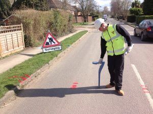
What does a Ground Penetrating Radar Survey entail?
With the use of the cable locating tools (RD8000) and generator, the area is scanned to single out the most obvious services first (these tend to be of metallic material). The area is then scanned with the GPR unit (RDS Detector Duo) to accurately locate the first findings and look for the non-metallic material such as gas, water, ducting, drainage pipes etc.
All the identified services are marked on the ground with marker paint or flags to show the line and depth. On completion of the Ground Penetrating Radar Survey, the information is recorded and can be presented to our customers with a CAD drawing. PIER (UK) also offer a full topographical survey, if required.
Other uses of the Ground Penetrating Radar Survey:
- Underground tanks
- Manholes
- Pits
- Voids
- Steel Reinforcement in concrete
- Many more…
PIER (UK) can supply Ground Penetrating Radar equipment, the RD8000 as well as a generator on a self-operated hire with durations to suit your requirements. Our team also provide training.
As the industry leaders in Vacuum Excavation, PIER (UK) will listen carefully to their customers’ requirements and provide a solution that is suitable for the job at hand.
To enquire about our hire fleet or Ground Penetrating Radar Surveys, you can contact our team on email or on 01925 228 674 who will be happy to answer any questions you may. Alternatively, you can view our latest projects on our Social Media platforms: Facebook, LinkedIn and Twitter.